Welcome to the district of Port Macquarie. This historic part of the Mid North Coast is renowned for its colonial past and for its urban koala population. It’s home to the Koala Hospital where guided tours are conducted every day at 3pm.
The Hastings Valley encompasses the towns of Wauchope, Telegraph Point and Rollands Plains, Laurieton, Camden Haven, Kendall and Comboyne, Port Macquarie, and Lake Cathie.
Port Macquarie is situated at the mouth of the Hastings River. Established in 1821 originally as a place for hardened British criminals and for convicts who had committed offences after arrival. The penal settlement was closed by the late 1820’s and the area was opened up to free settlers.
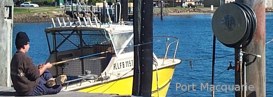
Port Macquarie is now one of the fastest-growing towns on Australia’s Holiday Coast with a wide array of activities and attractions to keep people of all ages amused. Its colonial past has left some lovely historic buildings like The Tacking Point Lighthouse and The Courthouse. Today fishing boats, pleasure cruisers and yachts share the waterways with seagulls and pelicans.
From humble beginnings of tents and rough bark huts of the 1820’s Port has thrived and there is now much development to cater for retirees and those seeking a sea change.
Town Beach is located close to the central business area of Port Macquarie. The best location for surfing is close to the river mouth. For swimming you should move back to the southern end of the beach to avoid the strong currents that prevail at the river mouth. An amenities block is at the southern end of the beach.
Flynn’s beach is one of many popular beaches in Port Macquarie. Proudly boasting a fine Surf club, which in turn suggests that this area is regularly patrolled by surf-life savers. Flynn’s beach is host to many surfing events, both local and state titles are held here. The beach is located near the town centre, and adjacent to caravan parks and holiday rental apartments.
Nobby’s beach is a very popular area to surf and sun, it offers excellent wind-breaks and privacy. The rocky ledges are a haven for “rock fishing” with many fine catches. A narrow path leads to the top of the small hill and provides a beautiful view up and down the rocky coastline.
Port Macquarie has a lot to offer from the long, white beaches next to the town centre to forests and mountains in the hinterland.
In addition you’ll find amusement parks, mini zoos, nature parks, cruises on the Hastings River and connecting waterways, horse-riding, watersports and fishing.
Pelican Bay is a quiet backwater, away from the flowing tidal currents of the main Hastings river with mountains as a backdrop. The bay is home to many itinerant ocean traveller’s, who anchor and enjoy the tranquil life of onboard living. Sailboarding is a popular activity, which caters for both experienced and novices alike. Two service clubs are located on the perimeters, a well appointed boat launching ramp is available.
The Hasting river is a very popular place for sailing, with world titles for eighteen foot hobie class being held here. An annual event is conducted on the river by the eighteen foot skiff’s, with a lot of world class action. Access to the ocean is less than a kilometre, and a good bar allow’s offshore racing, with some fine vantage points on the headlands to view the racing.
Nearby you will find Wilson River Primitive Reserve, enjoy spectacular views from No 1 Fire Tower at Cobrabald. A trip out to Trial Bay Gaol near South West Rocks is a must for the whole family.
Known as the “Heart of the Hastings”, Wauchope is the rail-head for the area. It’s a modern rural town with excellent sporting facilities — especially golf and water skiing — yet maintains its old world traditions. Colonial week, held each spring, commemorates Wauchope’s pioneering history.
This heritage is remembered too, at Timbertown, a recreated working village of 1880, where visitors can relive the past — or can enjoy Wauchope’s delightful rural charm at The Big Bull Farm and Animal Nursery. Admission to Timbertown is free.
The gateway to the hinterland, Wauchope is surrounded by the splendid beauty of forests and rugged mountains, rainforest reserves and National Parks.
Wauchope sits on the majestic Hasting’s River, which is a slow and sometimes serene waterway, somewhat reflecting the lifestyle of the area and its people. It’s journey starts at the base of the Seaview waterfall, in the Werikinbee forest, approximately 80 kilometre’s west of Wauchope.
An old steam engine is one of the many attractions at Timbertown, a re-creation town of the past, set in the 1880’s period. Colonial dress is part of the daily make-up. A genuine steam driven saw-mill operates at Timbertown, and will amaze you at the old time ingenuity.
Many fine old building’s remain, and are now part of the National Trust, such as the first bank in Wauchope, now called Jacaranda House. Wauchope has a strong link with the past through it’s Timber milling and logging industries. It has been the foundation of the local economy for over a century. The rich alluvial soils of the valley produce many litres of milk, which are processed at the local Dairy milk Co-operative, and bulk railed to the Capital cities.
History of the Village of Lake Cathie
This area is first referred to in the journal of Annabella Bowswell, niece of Major Archibald C. Innes, a prominent and wealthy early settler who owned much land in Northern NSW. She lived in the Innes mansion on the shores of Lake Innes from 1843 – 1848, and she records riding across the bar at Cati Creek on more than one occasion. She also mentions meetings with local Aborigines, and there are many Aboriginal sites still to be seen along this coastline.
There was no true settlement here until the 1930’s, although hunters and fishermen were active in the area and there were one or two fisherman’s huts.
Market gardening was begun on the south side of the creek in the 1920’s but the owners did not live here. The first permanent dwelling was built by Bob Pead on the land he owned on the south side; built high on the hill it commanded a fine ocean view, and later it became the Post Office. Others followed suit and a small community developed on the south side, reached by a rough road direct from the highway
Early in the 1950’s a telephone service was installed; followed by electricity in 1957 and mains water shortly afterwards.
The first bridge across the estuary, a four span timer bridge, was built by the community effort in 1957, and this opened up the north side for development, setting the pattern of the village as we see it today. Not until 1958 did the village finally get its Post Office.
The change in spelling of the name was required by the Postmaster General to avoid confusion with other Cattais in New South Wales, but the name is still pronounced Cat-eye.
Amenities and Attractions
Lake Cathie, with a resident population of only around 1500 , can provide everything visitors need for a quiet beachside holiday in the country.
Extensive shore reserves give access to safe estuarine beaches where children can play or swim in shallow water. The largest, Foreshore Reserve, has shelter shed, toilets, electric barbecues with sheltered picnic tables, children’s play equipment and a beach shower. Aqua Reserve, on the south side, has similar amenities but with fireplaces. Jabiru Reserve, west of the bridge, has a boat ramp with vehicular access and plenty of shade trees.
The creek is popular with fishermen, as are the many kilometres of ocean beach north and south of the estuary. The ocean beach near the entrance is patrolled in the Christmas holiday period, but at other times surfers are advised to seek advice at the surf centre before venturing into our surf. No vehicles at all are allowed on the Lake Cathie beaches between Middle Rock and the four wheel drive access just north of the village, to ensure the safety of beach users. Vehicle owners wishing to travel on the beach beyond these points will need to obtain a Hastings Council permit.
Bushwalkers will enjoy the large nature reserves which extend inland from our beach north of the village. Parts of these reserves are covered in Christmas bells in the summer. Please remember – all plants are protected by law.
Bowls and tennis are available in the village, and Port Macquarie Golf Course is only eight kilometres north along Ocean Drive. For those wishing for a trip on the water, canoes may be hired in the village, and larger craft in North Haven. Our bowling club is our recreation centre, and can provide meals for all the family.
Lake Cathie is home for a number of koalas, and they are regularly seen around the club. A reserve to the rear of the club is dedicated to them, and the community has planted many koala food trees to replace fallen timber. In this, our special Koala Reserve, you may sit quietly and watch the wildlife, but please, don’t bring your dog.
This information has been provided by Lake Cathie Tidy Towns Committee, with community co-operation.
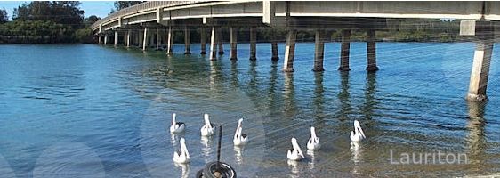
Thirty kilometres south of Port Macquarie are the scenic townships of Laurieton and Camden Haven. Once known as Peachtown, Laurieton is where Joseph Laurie arrived in 1840 to build a timbermill. The settlement was named after him or more probably by him. Once timber was the mainstay of the economy now fishing and tourism hold command.
The towering mountain to the back of Laurieton is called North Brother Mountain and was named by Captain James Cook. Hang-gliding is a popular activity from the top of the mountain, where favourable north-easterly winds provide the required lift.
The town has spread to the east and west, Dunbogan is the headland suburb, and Lakewood to the west is the lakeside suburb. Queens lake has a fine sailing club, with an enthusiastic group of mariners racing on the shallow lake.
Clean waterway’s, forest,national parks, unspoilt coastline and vast, almost hidden lakes, make traditional pursuits like sailing, waterskiing, fishing, bushwalking and surfing especially popular. A traditional holiday haven, so close.
Kendall
Kendall began as a small logging village and may have stayed that way had it not been for J. R. Longworth. They built one of the first trainlines in the area, simply for the purpose of getting their timber to Kendall from their holdings on the slopes of the Comboyne plateau. In this railway even the tracks were made of wood! What really sped up the process of habitation was the fact that a second railway was on its way, being built by Allen Taylor & Co. at Wootton, and so the race began. Now Kendall is thriving community with fortnightly markets, Every 1st & 3rd Weekend.
The Comboyne Plateau is situated above and behind Kendall and has fantastic views from its hilly countryside. Comboyne’s rich volcanic soil is its reason for success in growing potatoes. Comboyne has a very productive dairy industry because of the lush countryside.
The peaceful valley of Lorne sits quietly between the communities of Kendall and Comboyne. A tranquil farming district Lorne, or Delwood as it was once known, hosts a myriad of professions, from dairy farming to flower growing.
The majestic Ellenborough Falls are a well known attraction and are among the highest in the Southern Hemisphere

